Geotagalog
Take full advantage of the Places feature in iPhoto '09 using a GPS logger.
Attention shoppers: Geotagalog 2.0 is finally (almost) here! Learn about 2.0β...
Take full advantage of the Places feature in iPhoto '09 using a GPS logger.
Let Geotagalog and a GPS logger do the hard work of assigning Places metadata to your photos. Why import ungeotagged pictures into iPhoto, when it's so straightforward to GPS-enable your favorite camera?
View tutorial with sample GPS tracklog
Geotagalog's sophisticated automatic geotagging technology combines locations from a tracklog file with the pictures on your camera.
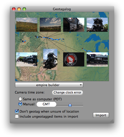 Simply open a tracklog and choose a photo source.
Make adjustments with a live preview, then easily import right into iPhoto '09.
Simply open a tracklog and choose a photo source.
Make adjustments with a live preview, then easily import right into iPhoto '09.